Three Capes Track in Four Days, Cabin to Cabin
Four days on Australia's highest sea cliffs and a cabin bunk every night: the Three Capes Track, from the boat at Port Arthur to the bus home.
Quick links
Don't want to read all this?
We've planned 2,000+ hiking trips. Send your dates, fitness and group size — we'll map the route and book every night.



What Is the Three Capes Track?
The Three Capes Track in Tasmania is a 48 km walk over four days and three nights along the sea cliffs of the Tasman Peninsula, inside Tasman National Park, about 90 minutes south-east of Hobart. The state's Parks and Wildlife Service built it and runs it.
You start with a boat from the Port Arthur Historic Site to Denmans Cove and sleep in three Parks cabins: Surveyors, Munro and Retakunna. The walk ends on the beach at Fortescue Bay, where a bus takes you back to Port Arthur.
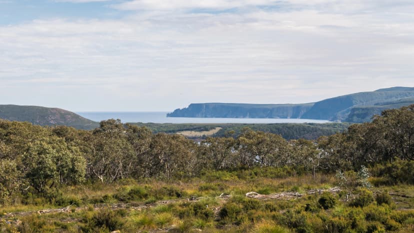
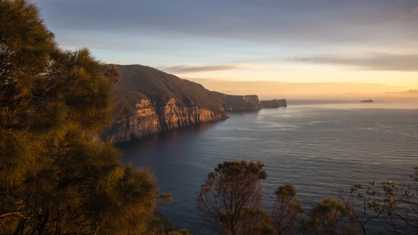
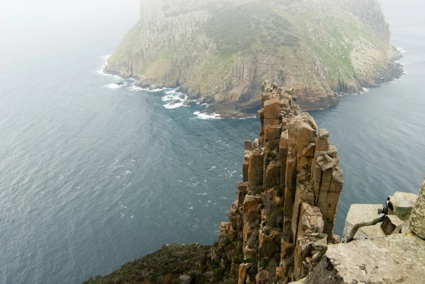
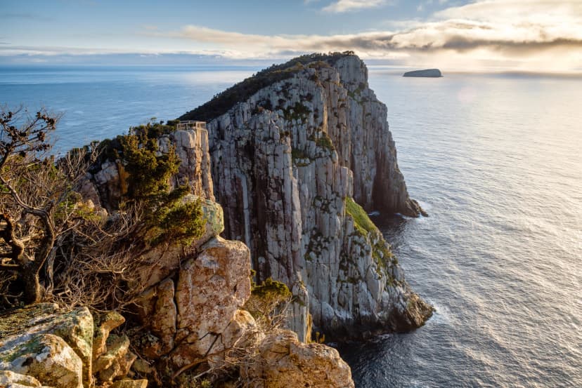
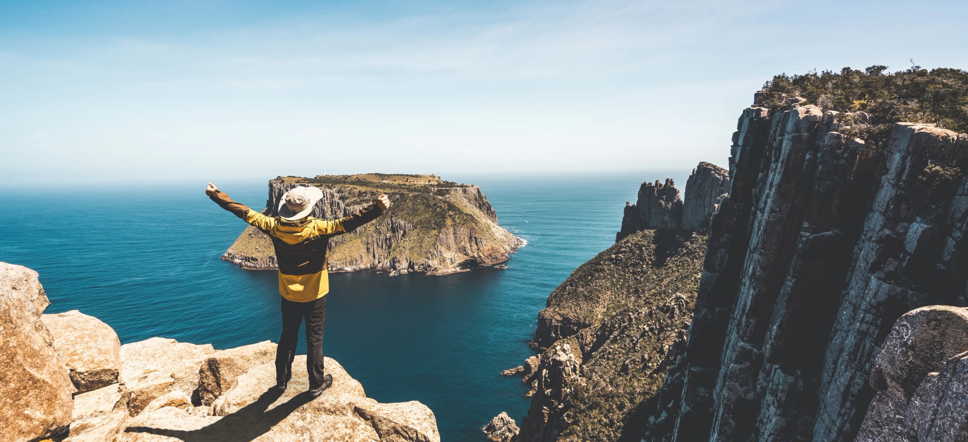
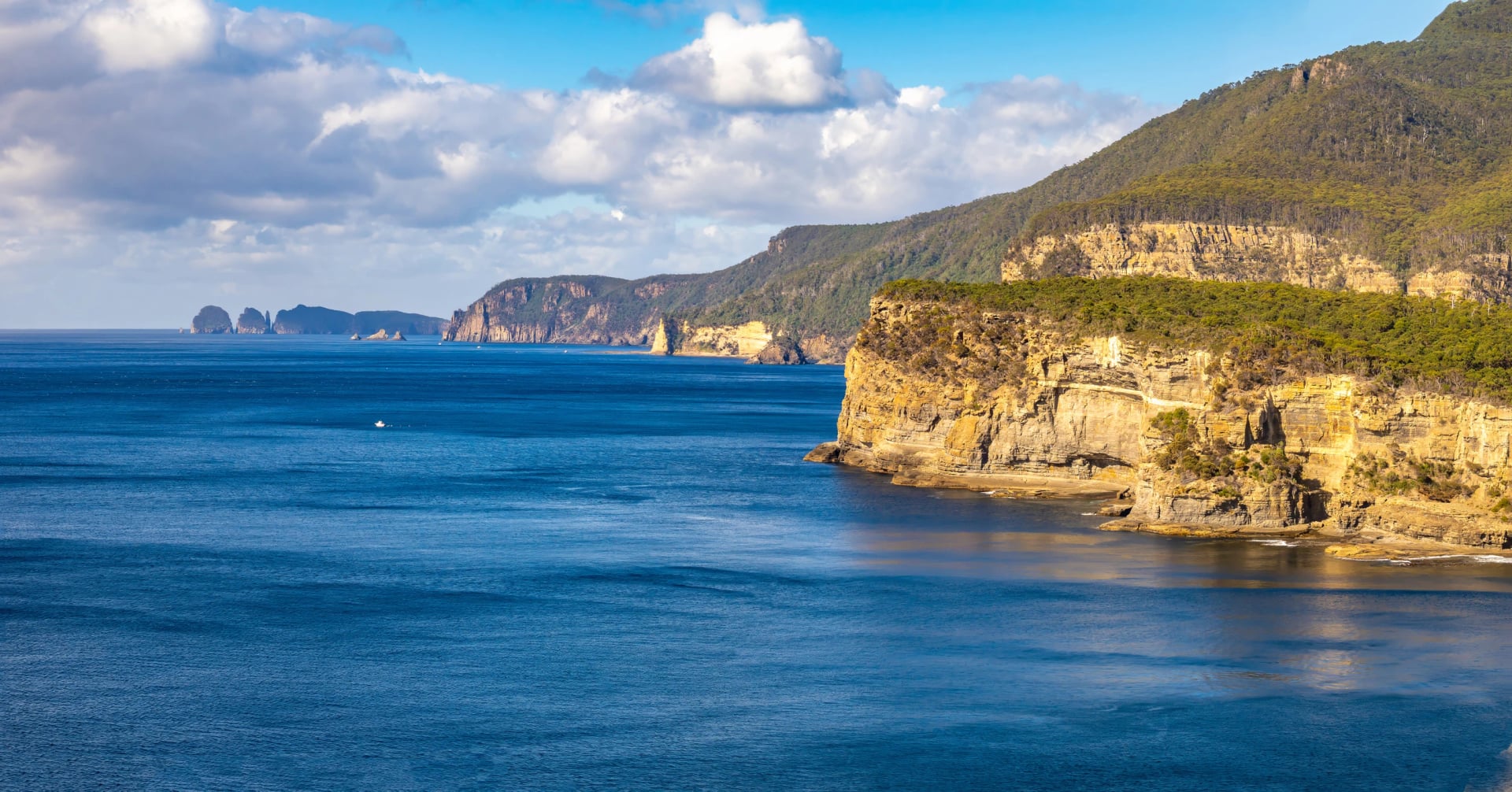
People walk it for the cliffs. The dolerite columns of Cape Pillar and Cape Hauy rise about 300 m straight out of the sea, and Parks Tasmania calls them Australia's highest sea cliffs. The track is part of the attraction too: a metre wide, built to a dry-boot standard, with 36 story seats and a guidebook to match.
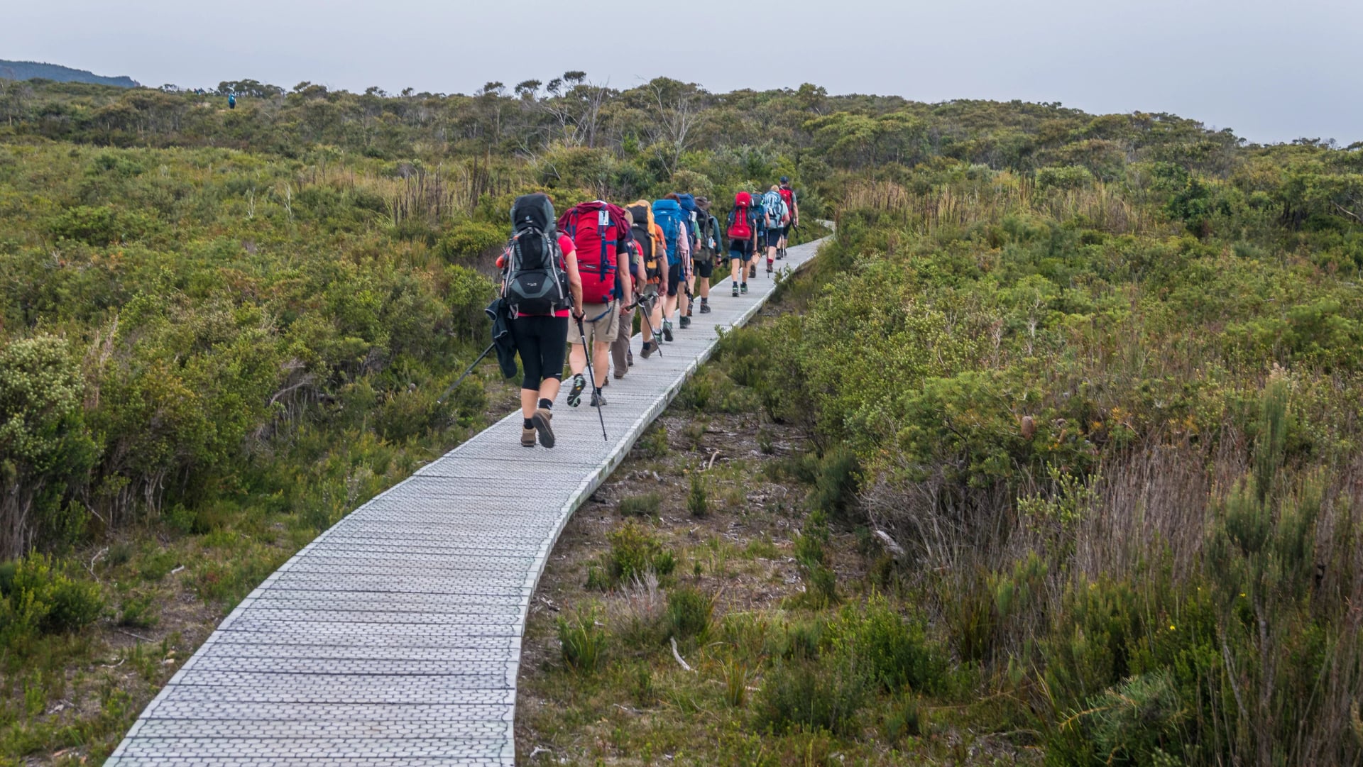
The first walkers set off on 23 December 2015, and Parks counted more than 106,000 walkers in ten years. The fact that shapes every plan is the bed: only 48 people start each day, each with a bunk booked, and there is no waitlist.
This guide takes the booking, the boat, the four days, the cabins, the weather and the packing in order, with the figures from Parks Tasmania's own pages, and ends with what to do when your dates are gone.
The Track in a Few Facts
Length and time: 48 km in four days and three nights, one way, Grade 3.
Start: a boat from the Port Arthur Historic Site to Denmans Cove, a cruise of up to 75 minutes.
Finish: Fortescue Bay, then a 30-minute bus back to Port Arthur at 2:30 or 4 pm.
Fee: AUD 650 an adult in 2026 to 2027, AUD 515 for a child or a concession card holder.
Capes on foot: Cape Pillar on day three and Cape Hauy on day four. Cape Raoul is a separate day walk.
Highest point: Mount Fortescue, 483 m, on the last morning.
Cost to build: AUD 25.3 million, shared by the federal and Tasmanian governments.
Three Capes Track Map
The track is not a straight line. It bends inland to two cabins, sends you out and back along Cape Pillar and leaves Cape Hauy as a second side trip before the drop to Fortescue Bay, so a map saves a lot of guessing about where the long days go.
Our map shows the four days in four colours, the three cabins, the two cape side trips, the boat from Port Arthur and the bus road out of Fortescue Bay. Open it before you book: the shape of day three decides whether you need a day pack.
On the ground you will not need it much. The track is signed and hard to lose, and the Encounters on the Edge guidebook you collect at check-in has a map for each day. TasMap sells a printed one.
Phone reception works on the first two days and most of day four. Day three has gaps, and Munro has the weakest signal.
The Four Days
Parks built the days to grow: a short afternoon off the boat, a half day, then the two big ones. The distances and times are Parks Tasmania's own, and the climbs are modest, because all the steep ground has steps. Day three is the one to train for.
Day | Distance | Walking time |
1. Denmans Cove to Surveyors | 4 km | 1.5 to 2 hours |
2. Surveyors to Munro | 11 km | 4 to 4.5 hours |
3. Munro to Cape Pillar and Retakunna | 19 km | 6 hours |
4. Retakunna to Cape Hauy and Fortescue Bay | 14 km | 6 to 7 hours |
The days run one way, from the boat landing to the bus stop, and nobody walks it in reverse or stays two nights at one cabin. Each day below carries the same four lines.
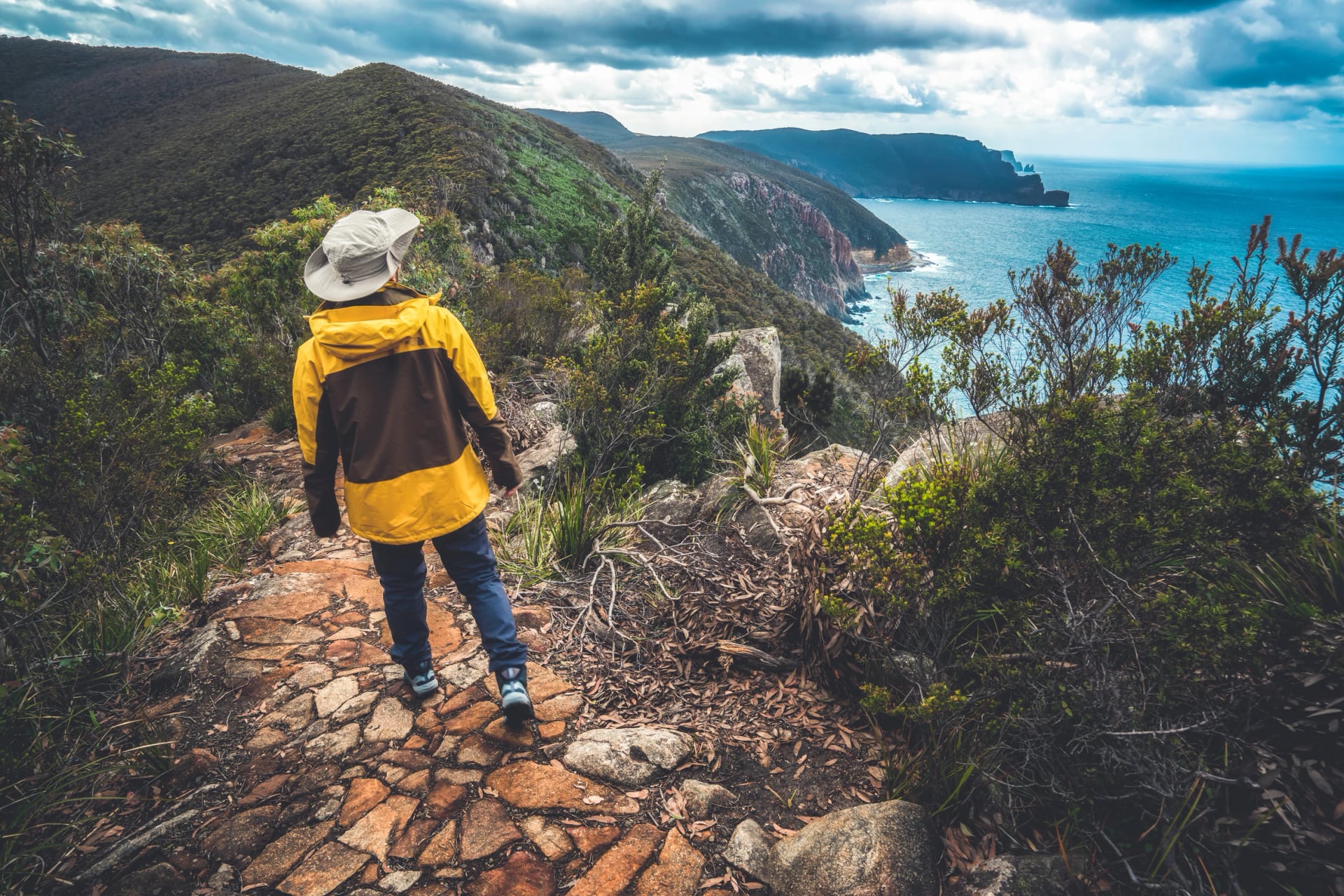
Day 1: Denmans Cove to Surveyors
Distance: 4 km
Walking time: 1.5 to 2 hours
Night: Surveyors cabin, with a deck facing Cape Raoul
Not to miss: the boat under the cliffs on the way to the start
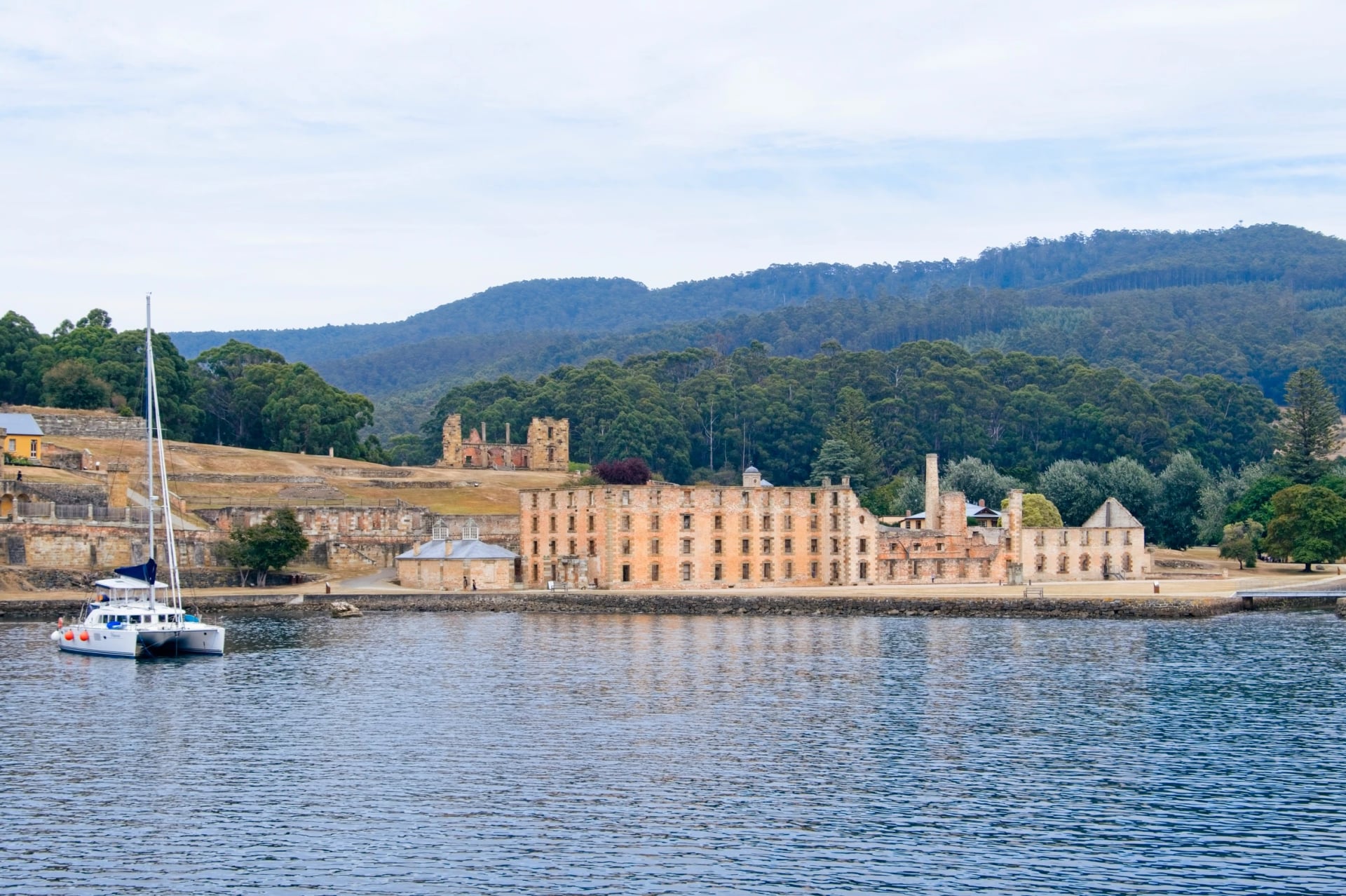
The day begins on the water. After check-in at the Port Arthur Historic Site you board Pennicott Wilderness Journeys' boat, The Blade, for a cruise of up to 75 minutes to Denmans Cove. There is no jetty: you step off the bow into the shallows and wade ashore, and between September and December the water can be knee-deep.
From the beach, two hours of eucalypt woodland and coastal heath lead to Surveyors cabin. It is a gentle start on purpose. The deck looks west to Cape Raoul, the cape the track does not visit, and the Host Ranger meets you with the room list.
Day 2: Surveyors to Munro
Distance: 11 km
Walking time: 4 to 4.5 hours
Night: Munro cabin, above Munro Bight with Cape Hauy across the water
Not to miss: the view from Arthurs Peak over Crescent Bay to Cape Raoul
Day two climbs early. A short pull up Arthurs Peak, 313 m, opens the first big view: Crescent Bay's white sand below and Cape Raoul beyond it. The track then skirts Crescent Mountain and crosses the Ellarwey Valley, the most exposed stretch of the walk, open moorland where the wind has nothing to slow it, before the forest closes in again.
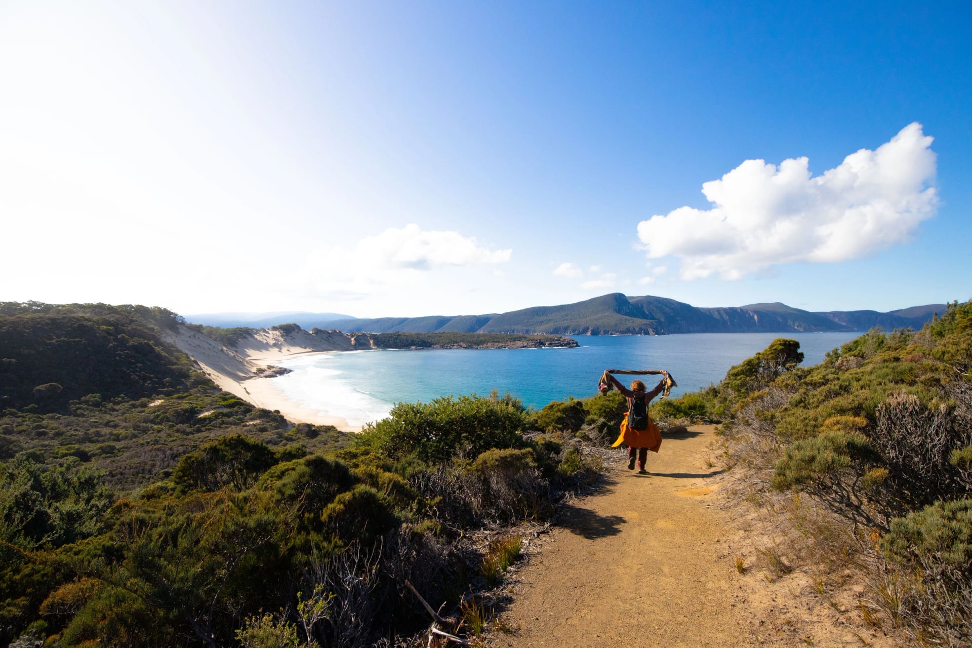
Munro is the social cabin. It has the only showers on the track, two of them outdoors, and its deck faces Munro Bight and the long line of Cape Hauy. You come back here tomorrow, which is why Parks lets you leave your pack behind.
Day 3: Munro to Cape Pillar and Retakunna
Distance: 19 km
Walking time: 6 hours, with about 650 m of climbing
Night: Retakunna cabin, below Mount Fortescue
Not to miss: the Blade, the narrow ridge at the end of Cape Pillar
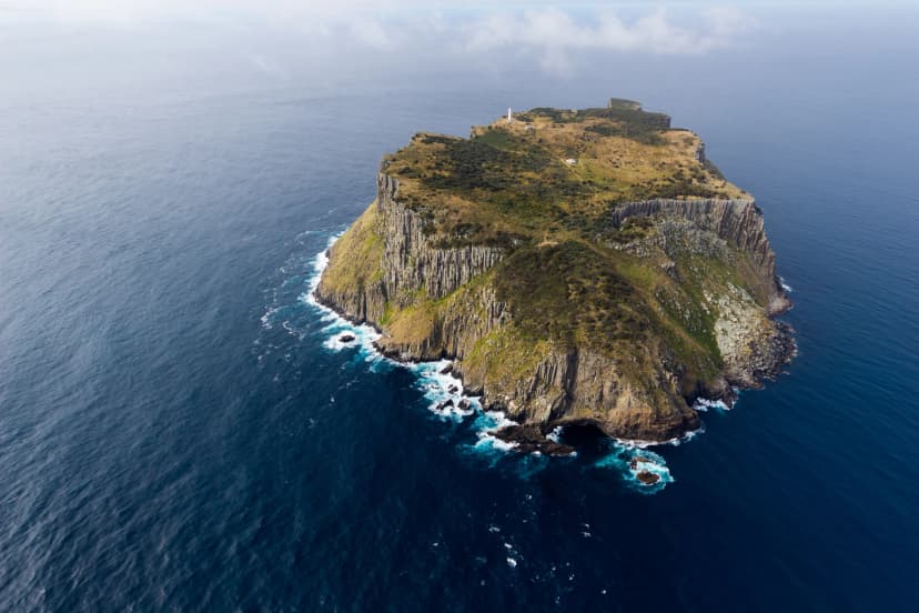
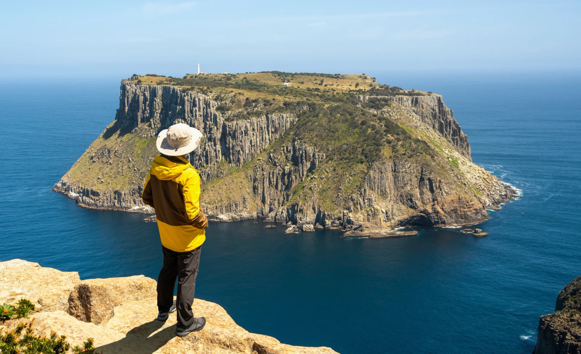
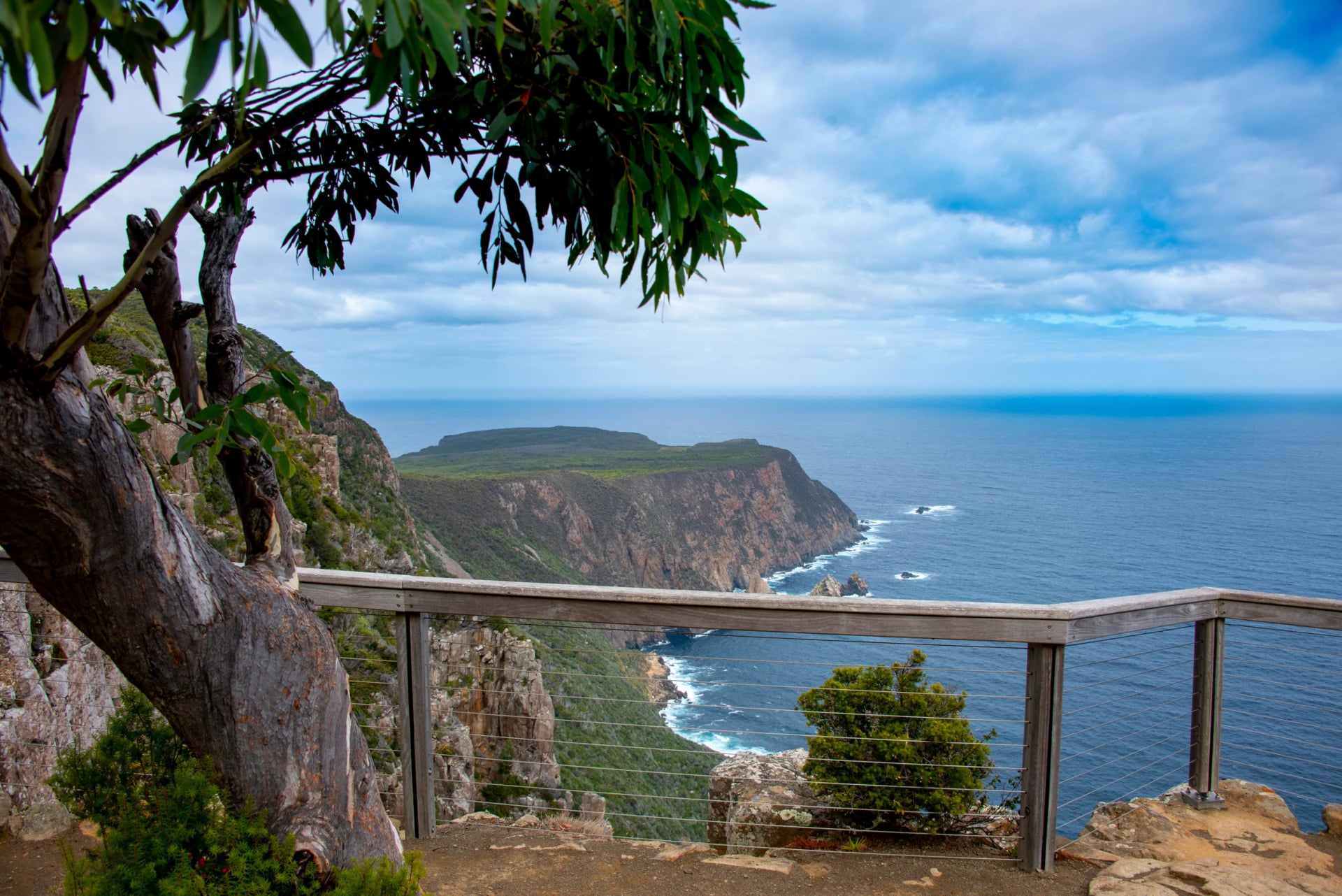
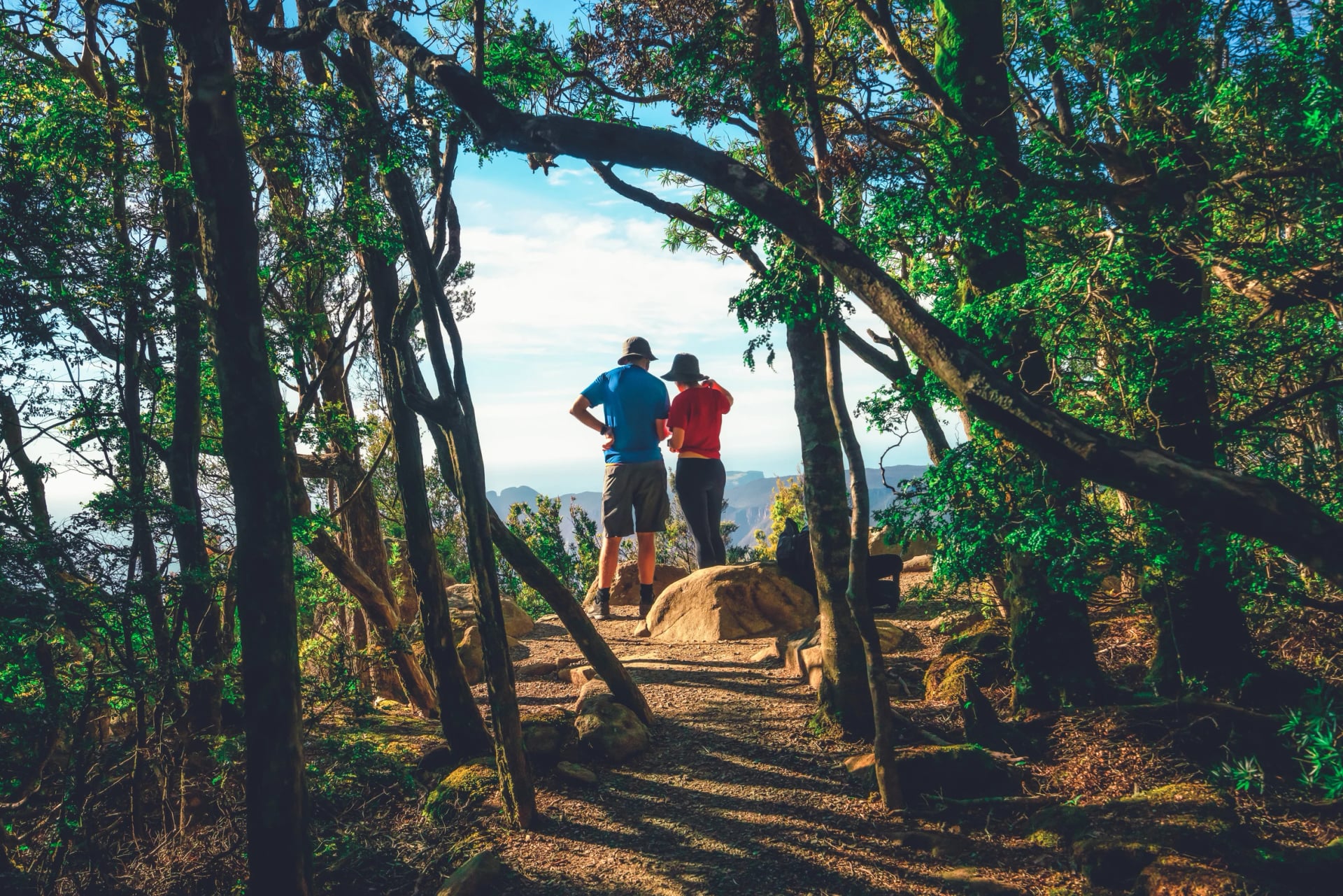
This is the day the track is named for. From Munro the path runs out along Cape Pillar to the Blade, a knife of dolerite that ends in the air, with Tasman Island less than 500 m away across the Tasman Passage. The cliffs drop about 300 m to the sea. Parks asks you to stay two metres from any edge; the built lookouts give the same view in safety.
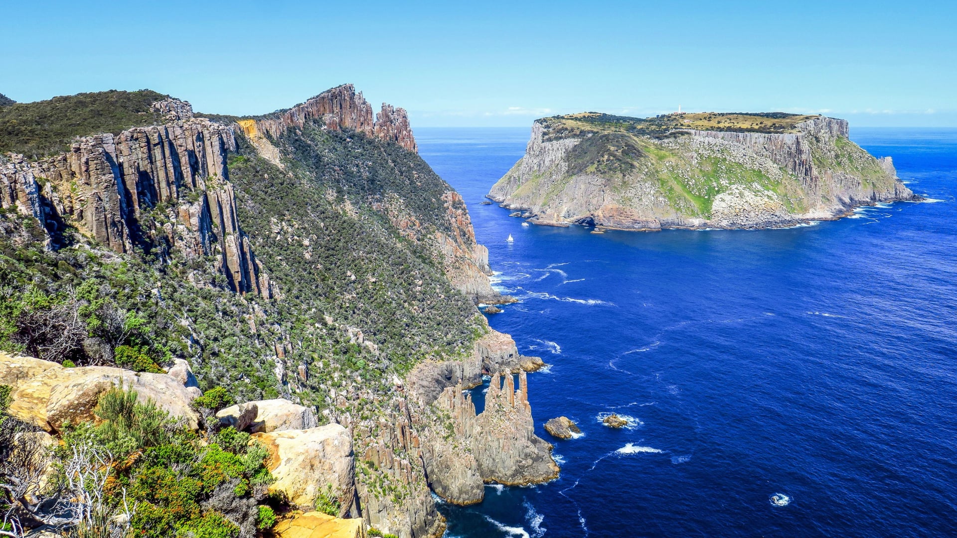
The cape is an out-and-back, so you walk it with a day pack and collect your main pack from Munro on the way through. The last stretch heads north through forest and heath to Retakunna cabin, with tomorrow's climb, Mount Fortescue, filling the view.
Parks says to be fit enough for 19 km and about 650 m of climbing in six to seven hours, and this is the day it means. Train on hills with a loaded pack, as Parks suggests, and the day is a pleasure rather than a test.
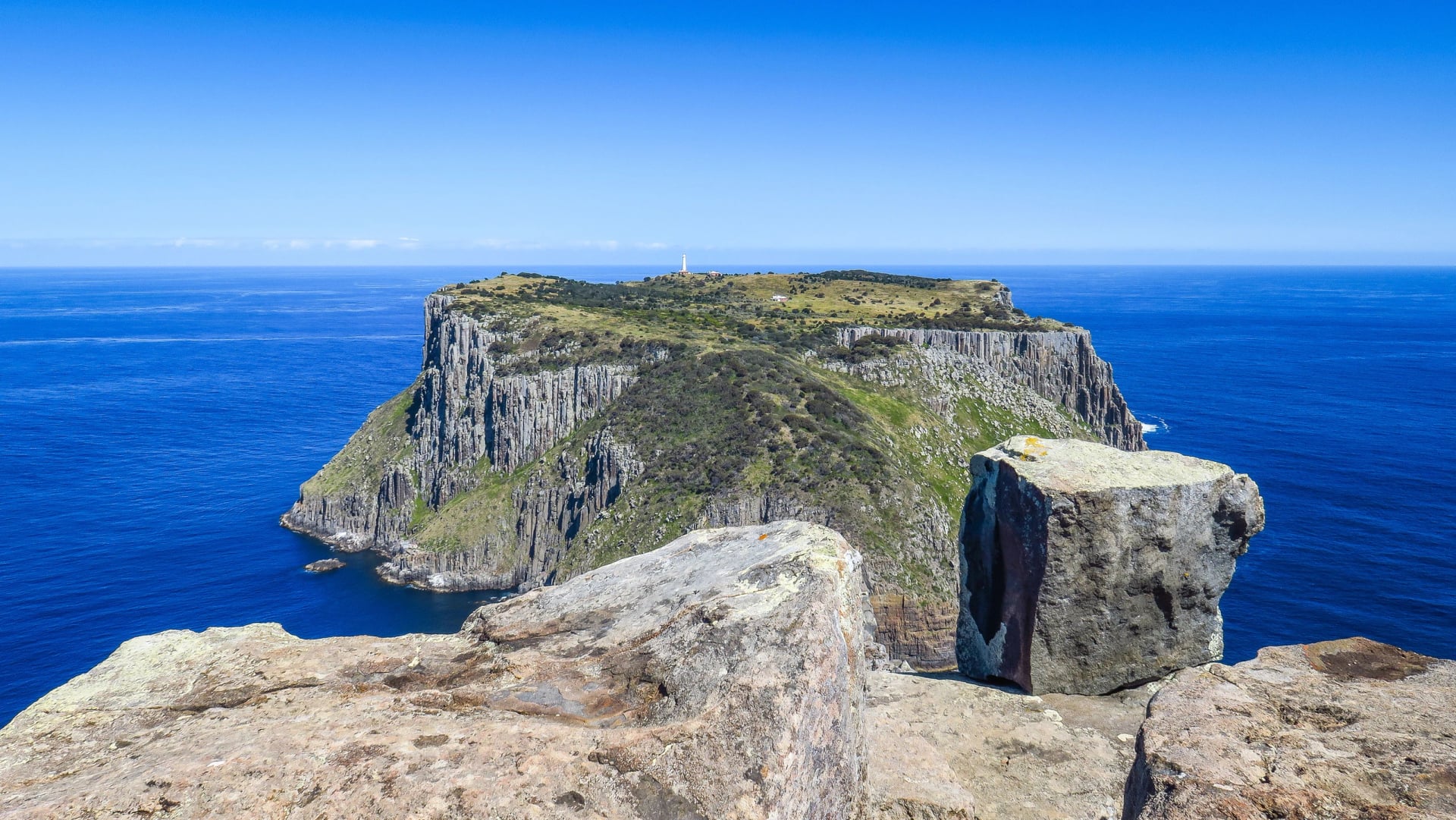
Day 4: Retakunna to Cape Hauy and Fortescue Bay
Distance: 14 km
Walking time: 6 to 7 hours
Night: your own bed, in Port Arthur or Hobart
Not to miss: the Totem Pole off the tip of Cape Hauy
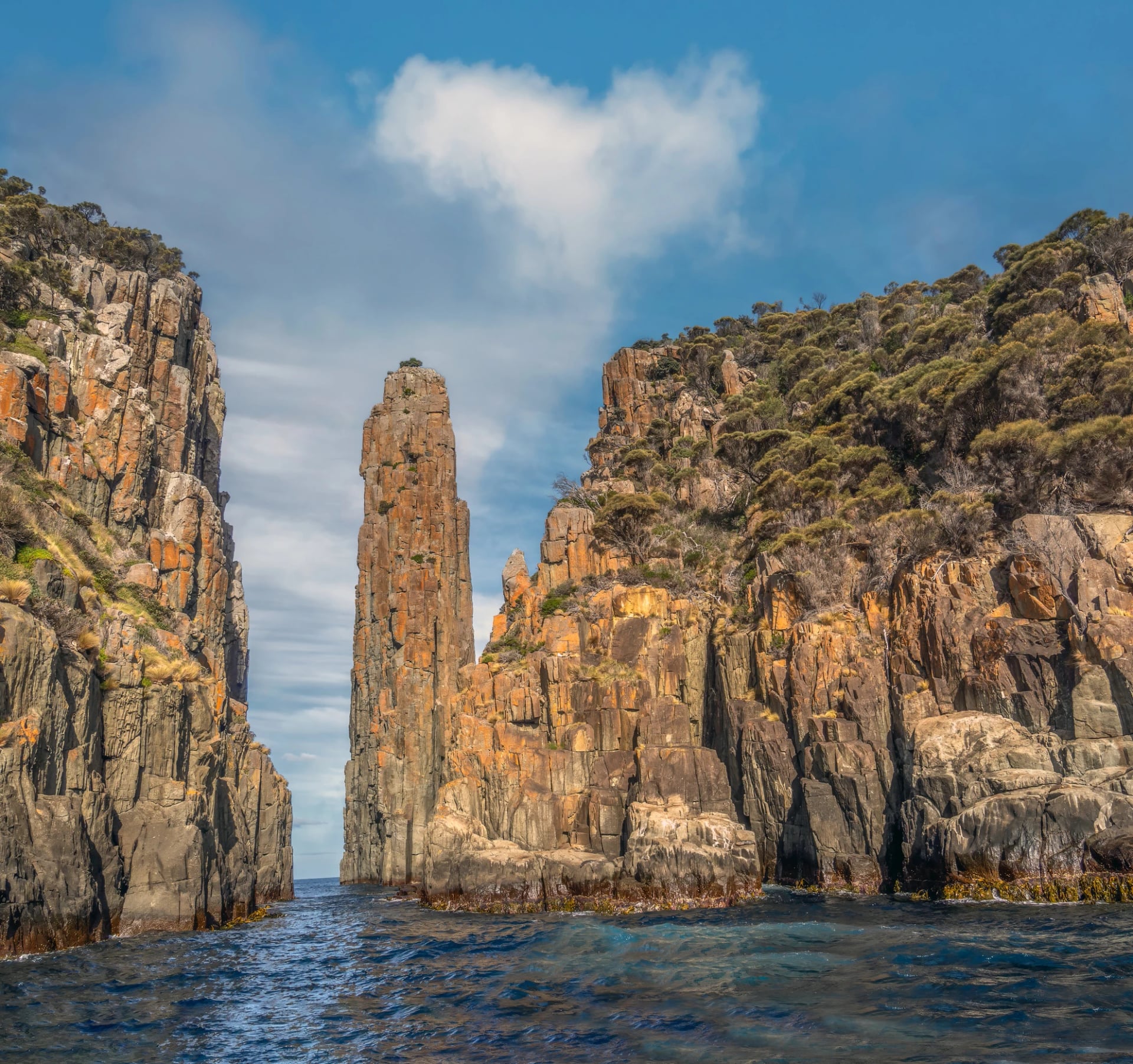
Start early. The day opens with the climb of Mount Fortescue, 483 m and the highest point on the track, through tall wet forest that drips long after the rain stops. From the top the path drops to the Cape Hauy junction and the second side trip: stone steps down and up along the cape to the lookout above the Totem Pole, a 65 m sea stack, and the Candlestick.
From the junction it is mostly downhill to Fortescue Bay. The beach is white sand and cold, clear water, and a swim before the bus is a Three Capes tradition, so keep the bathers near the top of the pack. The bus leaves at 2:30 pm and 4 pm and takes 30 minutes to the Historic Site; you pick the time when you book.
The Cabins
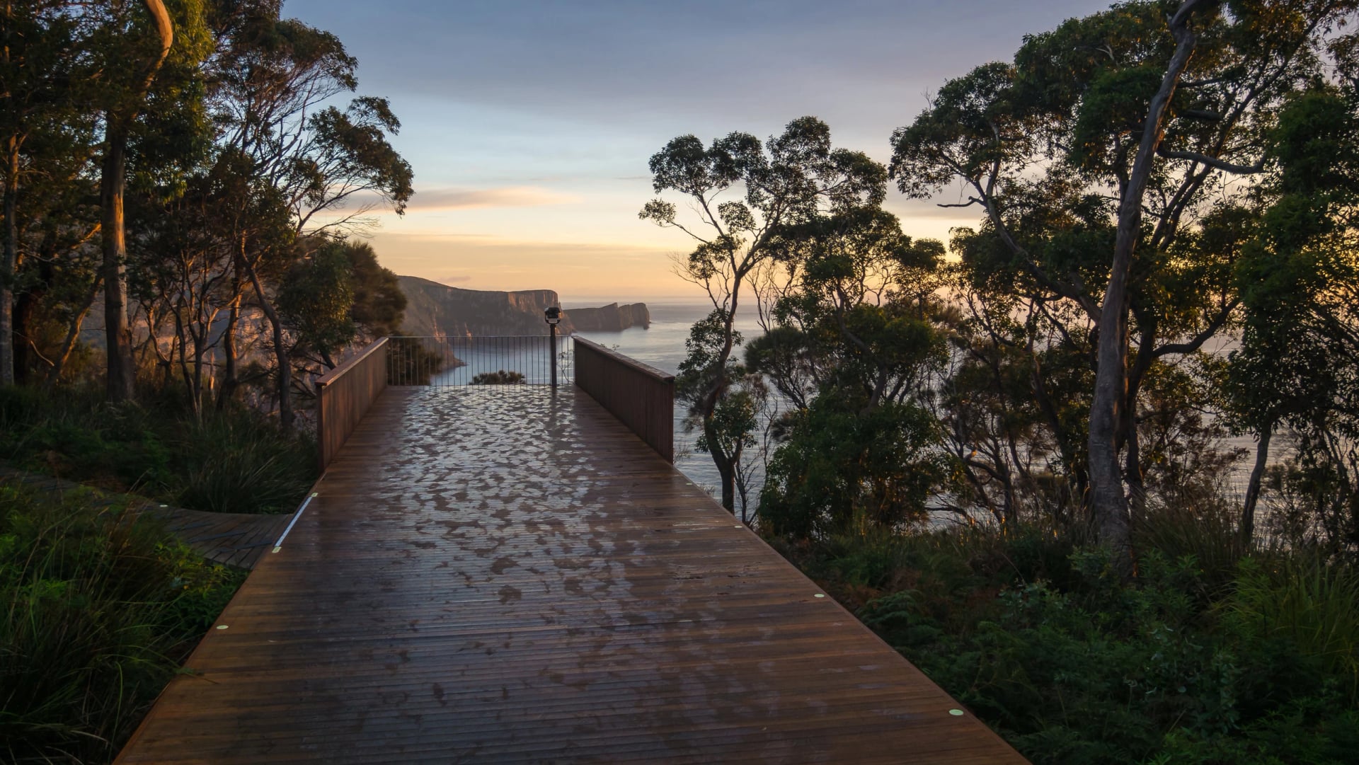
Where you sleep is what separates this walk from every other multi-day track in Tasmania, so here is what the cabins give you. The three sites were built for helicopter servicing and bushfire safety as much as for the view, and won the Grand Prix at the Australian Timber Design Awards in 2016.
Each site has two sleeping cabins joined by a deck and a separate social building. Parks provides at every one:
Beds: a bunk each with a vinyl mattress, 203 cm by 90 cm, in six rooms of four and three rooms of eight with a half wall down the middle.
Kitchen: four-burner gas cooktops, pots, pans, kettles, chopping boards and serving spoons; no fridge, microwave or oven.
Heat and light: a pellet heater and lights in the social hub; the sleeping rooms have neither.
Water: rainwater from tanks, which Parks asks you to treat before drinking.
Power: shared USB sockets at 5 volts, enough for a phone and a camera battery.
Washing: toilets a short walk from the bunks, and two outdoor showers at Munro only.
Company: a Host Ranger, a reference library and board games.
Rooms are allocated by the Host Ranger, who tries to keep one booking together. If friends book separately, name your group in the comments box, or you may end up in different rooms.
How the Booking Works
Everything on the track comes in one Parks booking, which makes it simple, and also makes the booking the hard part: the 48 places a day sell as one package of boat, bunks and bus, and nothing waits for you when they are gone. Here is the order to do it in, from the calendar to the check-in desk.
Choose your dates around the closures. The track shuts for two weeks each autumn for maintenance and fuel-reduction burns: 5 to 18 April 2027, 24 April to 7 May 2028 and 9 to 22 April 2029. Demand is highest from September to April.
Book on the Parks Tasmania booking site. The Three Capes Track availability calendar shows what is left. Pick your boat, 11:30 am or 1:30 pm from May to September and 11:30 am or 2 pm from October to April, and your Fortescue Bay bus, 2:30 or 4 pm.
Pay the fee. AUD 650 an adult, AUD 515 for a child or a holder of an Australian concession card, in 2026 to 2027. Parks ran a winter rate of AUD 485 for new bookings departing in July and August 2026, and it reviews fees each year with inflation.
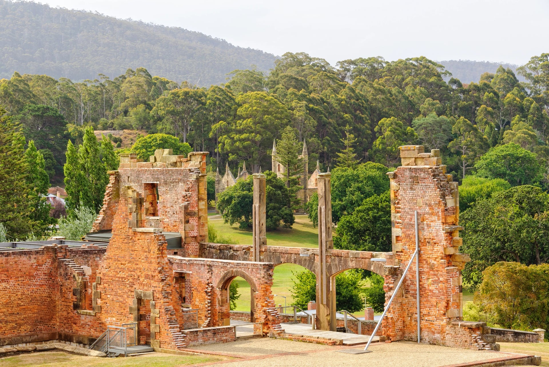
Check in at Port Arthur. The walkers' check-in room is downstairs in the Historic Site's Visitor Centre. Arrive 60 to 90 minutes before your boat with your booking receipt and any concession card. Children under 18 walk with an adult; Parks says the track does not suit children under five.
What the Fee Covers
Three nights in the cabins, self-catered.
The Pennicott cruise from Port Arthur to Denmans Cove.
Entry to the Port Arthur Historic Site for two years, with parking and a locker.
The bus from Fortescue Bay back to the Historic Site.
The Encounters on the Edge guidebook with maps.
Park entry for the walk plus a day either side.
Changes and Cancellations
You can move your date free of charge with more than three days' notice, subject to availability. A refund more than 14 days out costs 25 percent of the fee, medical reasons included; the Parks terms and conditions have the rest.
Independent, Guided or From a Bed?
Three different trips share the name Three Capes, so compare them before you pay anyone. The Parks walk is the one above, and one licensed operator runs a guided version with its own lodges inside the park. Then there is our way: the same capes from one Port Arthur room, with a driver to a different trailhead each morning.
Parks hut walk | Guided lodge walk | Our Port Arthur version | |
Where you sleep | Shared bunk rooms in three Parks cabins | Private lodges in the park, with a guide | One room in Port Arthur for three nights |
What you carry | Everything, about 12 kg | A day pack; the lodges hold the rest | A day pack; your bag stays in your room |
Cape Raoul | Seen from Surveyors and Arthurs Peak | Not on the route | Walked, 14 km, with fur seals below the point |
Cape Pillar | On foot, out to the Blade | On foot | From the water, on a cruise under the cliffs |
Who books it | You, on the Parks site | The operator | Our agents, including the parks pass in your name |
The Parks walk asks for a bunk room and a full pack; the lodge walk costs the most and skips Cape Raoul. Ours trades the Blade for Cape Raoul and sees Cape Pillar from the sea, the one to pick when the Parks calendar is empty for your dates.
Getting There
The walk starts and ends at the Port Arthur Historic Site, 90 minutes south-east of Hobart on the Arthur Highway, and the day-one boat does not wait. Arrive the day before if you fly in, because no coach from Hobart meets the 11:30 am boat with time for check-in. The ways down the peninsula:
Your own car: 90 minutes from Hobart on the A9, slower at dusk when wallabies cross the road. Parks keeps a long-term car park for walkers inside the Historic Site, about 500 m from the Visitor Centre.
The Pennicott bus: Pennicott Wilderness Journeys runs a walkers' coach from Franklin Wharf in Hobart at 7:45 am, reaching Port Arthur at 9:45 am. The return leaves the Historic Site at 4:45 pm and reaches the airport at 6:15 pm and Hobart at 6:45 pm. It costs AUD 40 each way and must be booked ahead; an 8:30 am airport pick-up can be arranged.
The public coach: Tassielink's route 734 runs from Hobart through Dunalley and Eaglehawk Neck to Port Arthur every day, with fewer services at weekends. Check the departures against your boat time.
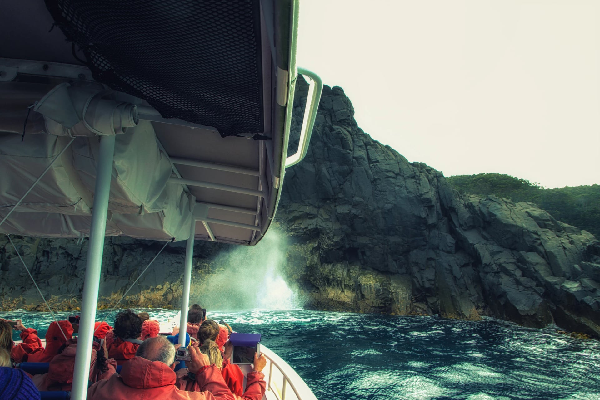
On the boat, dress for the landing: shorts or trousers that roll above the knee, and your towel where you can reach it. Luggage you do not want on the track goes into the Historic Site's luggage store or a locker for the four days, both included in the fee.
When to Go
The track is open all year, and the season you pick changes the walk more than the fitness you bring. Parks calls the climate maritime, with water on three sides holding the temperature steady: summer highs of 16 to 19 °C and winter highs of 10 to 12 °C on the track.
The Bureau of Meteorology's station on Tasman Island, 240 m up and the nearest to the Blade, has recorded since 1977. Here is a season-by-season picture from its normals:
Season | Daytime high, Tasman Island (BOM, 2001 to 2026) | What you get |
Summer, December to February | 17 to 18 °C | Long days, the busiest cabins and the most swims |
Autumn, March to May | 13 to 17 °C | Settled weather, whales passing, the April closure |
Winter, June to August | About 11 °C | Empty bunks, cold clear nights and a chance of the aurora |
Spring, September to November | 13 to 15 °C | Heath in flower, migrating whales and a knee-deep landing |
Rain falls on 10 to 12 days a month in every season, August is the wettest at about 74 mm, and the wind never really stops: the old lighthouse station measured a mean 9 am wind above 20 km/h in every month. Sea fog comes and goes whatever the season, so layers beat one thick jacket.
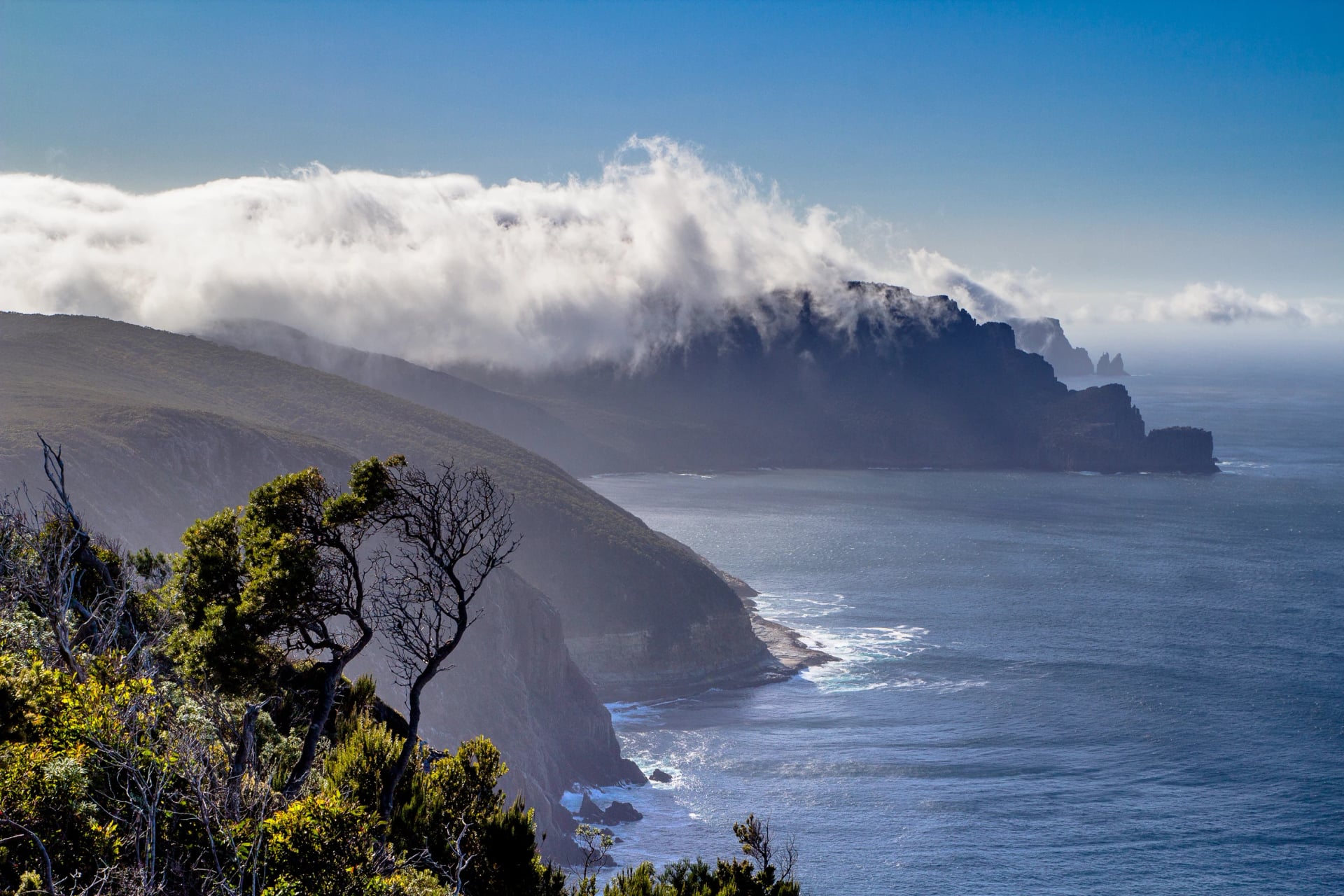
Winter is Parks' own tip for the night sky and the swells against the cliffs, and the cabins are quietest then. The sleeping rooms are unheated all year, so a sleeping bag rated to minus five decides a winter walk. Spring adds the heath in flower; autumn brings orchids, whales and the April closure.
What to Pack
Parks has done the hard thinking for you, and its packing list, a PDF on the track's page, is the one to follow: a pack of about 50 litres weighing no more than 12 kg, water included. The cabins carry the kitchen, so what you add is the bedroom and the food. Here is what changes against an ordinary day walk:
A sleeping bag rated to minus 5 °C, plus a liner, because the bunks have mattresses and nothing else.
A head torch with spare batteries, since the sleeping rooms have no lights.
Your own bowl, plate, mug and cutlery, plus a tea towel; the pots, pans and cooktops are provided.
Three breakfasts, four lunches, three dinners and snacks; there is no fridge and no shop after Port Arthur.
No stove and no campfire gear: the track is a fuel-stove-only area and the cabins have gas cooktops.
A small day pack for the Blade on day three, when your main pack stays at Munro.
Two litres of water capacity and a way to treat the tank water.
Waterproof jacket and overpants, thermals, a beanie and gloves, even in January.
Bathers and a quick-dry towel for the landing and the last-day swim.
Sandals for the cabins and ear plugs for the bunk rooms.
Bring sturdy snap-lock bags: everything you carry in comes out with you, rubbish included. A personal locator beacon is not provided, and only the first two days have reliable phone reception, so hire one in Hobart if you walk alone.
Cape Raoul, the Cape Left Out
The name promises three capes and the track walks two, which is the question walkers ask most once they have the map in front of them. Cape Raoul is seen, never reached: from the deck at Surveyors and from Arthurs Peak it fills the western horizon, and the track never turns towards it.
Your Three Capes pass covers Tasman National Park for a day either side of the walk, and Parks suggests using it. The Cape Raoul track is 14 km return, graded 4, about five hours from the Stormlea Road car park through tall forest to a plateau of heath and dolerite columns above a fur seal colony. Remarkable Cave, Mount Brown and Crescent Bay make a shorter day from Port Arthur.
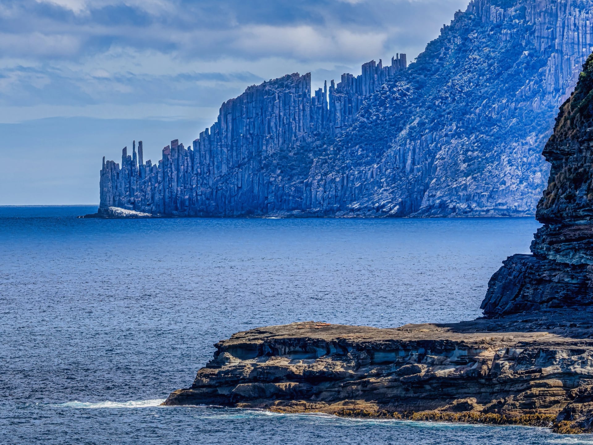
That is also the logic of our own Three Capes walk. We sleep in Port Arthur for three nights, send a driver to Fortescue Bay for Cape Hauy and to Stormlea Road for Cape Raoul, walk the Tasman Coastal Trail on the third day and cruise under Cape Pillar on the last. All three capes, on foot or by water, without a bunk room or a 12 kg pack.
Our guide to walks in Tasmania sets the peninsula beside Maria Island, Freycinet and Cradle Mountain if you have more than four days. With a week to spare, the Bay of Fires walk carries on up the east coast from here, and every night of it has a bed with a door of its own.
When the Track Is Full
Tell us when you want to be on the peninsula and what sort of night you want after the cliffs. If the Parks calendar has your dates, we will say so and leave you to book it, because nobody should pay twice for one walk. If it does not, or a shared bunk room is the part you dread, our agents build the same four days from a private room in Port Arthur. Take a look:
Base: one room in Port Arthur for three nights, dinner and breakfast arranged
Walks: Cape Hauy, Cape Raoul and the Tasman Coastal Trail, each with a driver to the start
Cape Pillar: a three-hour cruise under the cliffs and Tasman Island on the last day
Write to us through our inquiry form with your dates and we will check the Parks calendar for you first. Prefer to talk it through? A short video call settles most of it: book one with one of our agents.
Frequently Asked Questions



Plan with a hiking expert
Free advice from a team that knows these routes inside out - real people, not a bot

HASSLE-FREE
We handle itineraries, accommodations, and anything else you prefer not to deal with, so you can enjoy a carefree hike.

BOOK WITH CONFIDENCE
We are a financially protected company, fully bonded and insured, keeping your money safe and allowing you to travel with confidence.

TRIED & TESTED ADVENTURES
We chose these walks for the scenery, then made sure each has a roof every night and needs no hire car.

HELP ON THE WALK
Plans changed, or something not as booked? Ring the support number in your guidebook. For police, fire or ambulance, call 000, even without credit.