Tasmania Hikes: Sea Cliffs, Wombats and Cradle Mountain
Climb stone steps above the Totem Pole, pass wombats on Maria Island and walk down to Wineglass Bay: Tasmania's hikes, and how to reach them without a car.
Quick links
Don't want to read all this?
We've planned 2,000+ hiking trips. Send your dates, fitness and group size — we'll map the route and book every night.



Tasmania is the kind of place where a short walk turns into a long one. You set off for a lookout and end up on a cliff edge high above the sea, or you follow one beach round the point to the next, and then the next. On Maria Island the wombats graze beside the path, Wineglass Bay curves away below the saddle, and up on the plateau around Cradle Mountain it can snow in the middle of summer.
We wrote this guide for walkers planning a first trip to the island. It goes region by region through the day hikes and the multi-day tracks, with a map for every route, and it covers the practical side that catches people out here, from park passes to ferry times. Where we arrange a walk ourselves, we say so. Where you would plan it on your own, we tell you how.
Where to Hike
Tasmania's hikes fall into four regions, a few hours apart by road:
The Tasman Peninsula: sea cliffs and capes, about 90 minutes south-east of Hobart
The east coast: Maria Island, then Freycinet, then the Bay of Fires, all off one coast road
Cradle Mountain and the Overland Track: lakes, dolerite peaks and buttongrass on the alpine plateau
Hobart and the south-west: Kunanyi above the city, the waterfalls of Mount Field and the wild South Coast Track
The coast is the easier place to start. Its walks are shorter, a town is never far away, and every trailhead has a bus, boat or transfer. The plateau deserves days of its own, with a spare one behind the summit day, because Parks Tasmania warns that the weather changes quickly, "especially in mountain areas".
See our interactive map with each hike marked:
The Tasman Peninsula
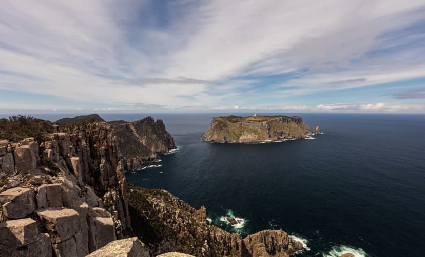
If you only have a few days in Tasmania, spend them here. The peninsula ends in some of the most dramatic sea cliffs in the country, and nearly all of its walking lies inside Tasman National Park. Two of its three great capes are day hikes from a car park; the third, Cape Pillar, takes a multi-day walk or a boat.
Cape Hauy
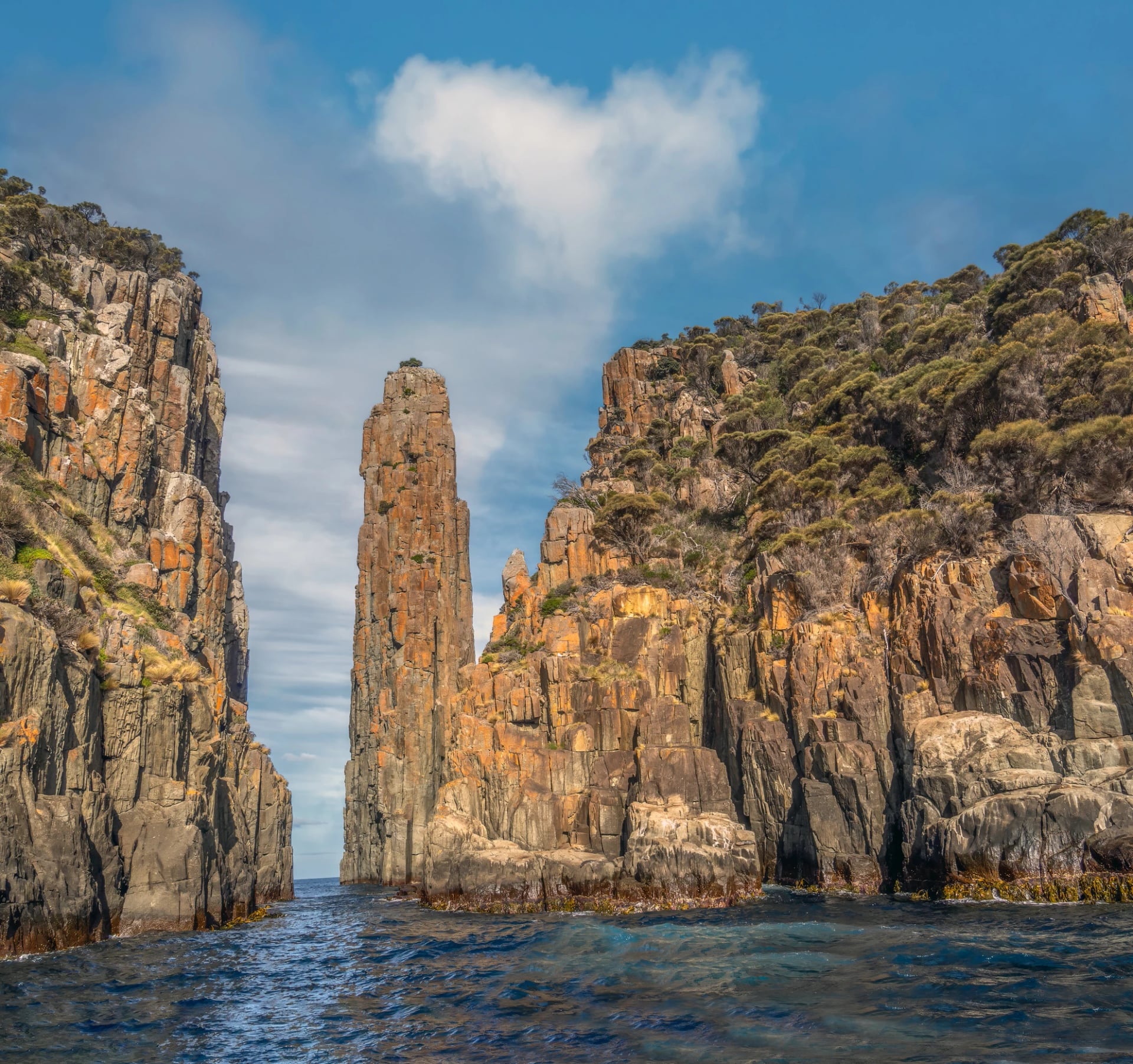
Cape Hauy is the shorter, steeper cape. The track leaves Fortescue Bay's beach, climbs through forest and then follows the cape out over a string of saddles, down and up again on stone steps, to a lookout high above the Totem Pole sea stack.
Return: 9.4 km, about 4 hours
Start: Fortescue Bay, at the end of 12 km of unsealed road that no bus travels
Watch for: steps both ways, so the walk back is as steep as the walk out
Our agents drew the route out to the lookout, so you can see how far the cape runs into the sea:
Cape Raoul
Cape Raoul is the longer, quieter cape, out at the south-western tip of the peninsula, and the Three Capes Track doesn't go there. The track climbs through forest onto a plateau of low heath, then follows its edge out to the point, where the rock splits into tall columns over the sea. Parks Tasmania suggests keeping an eye out for seals on the rocks below.
Return: 14 km, about 5 hours, grade 4 on Parks Tasmania's 1 to 5 scale
Start: a car park at the end of Stormlea Road, 9 km of it dirt
Plan for: a transfer or a taxi from Port Arthur, booked the day before
Here is the track on the map, from the car park on Stormlea Road to the tip of the cape:
The Three Capes Track
The Three Capes Track is a four-day hut walk: 48 km and three nights, one way, built and run by Parks Tasmania, with no more than 48 walkers starting each day. It begins with a boat from Port Arthur to Denmans Cove, where you may step off into knee-deep water between September and December, and ends at Fortescue Bay, with a bus back to Port Arthur. The third day is the big one: 19 km out along Cape Pillar to look across at Tasman Island, then back to the last cabin.
A place costs $650 an adult in 2026–27, including the boat, the bus, entry to the Port Arthur Historic Site and park entry. There is no waitlist, and the track closes for maintenance 5–18 April 2027. The cabins themselves are compared with Tasmania's other huts under Where You Sleep, further down.
To picture how the four days fit together, follow the route and the three cabins on this map from our hiking experts:
Three Capes Track | The capes from a bed | |
Where you sleep | Shared bunk rooms in Parks cabins | Your own room at Port Arthur |
What you carry | Sleeping bag, food and kitchen kit | A day pack |
Cape Pillar | On foot, out on the clifftops | From the water, under the cliffs |
Cape Raoul | Not on the route | A day hike from Stormlea Road |
Booking | Parks Tasmania | Our agents |
Booking transfers along gravel roads, a boat trip and a room for every night can get overwhelming. If you'd rather it was all done for you, take a look at our ready-to-walk version: the planning is finished before you arrive, and our team supports you while you're on tour.
The East Coast
North of Hobart, the coast changes every couple of hours along the road: first an island with no cars, then a peninsula of pink granite, then a run of beaches where lichen paints the boulders orange. It is also the easiest region to link up without a car, as the week-long plan further down shows.
Maria Island and the Bishop and Clerk
Maria Island has no cars and no shops, so the ferry from Triabunna sets the day. Encounter Maria Island runs four boats each way from September to April, the first out at 8:30 am and the last back at 4:15 pm. The crossing takes 30 minutes according to the operator and 45 according to Parks Tasmania, so be at the wharf early.
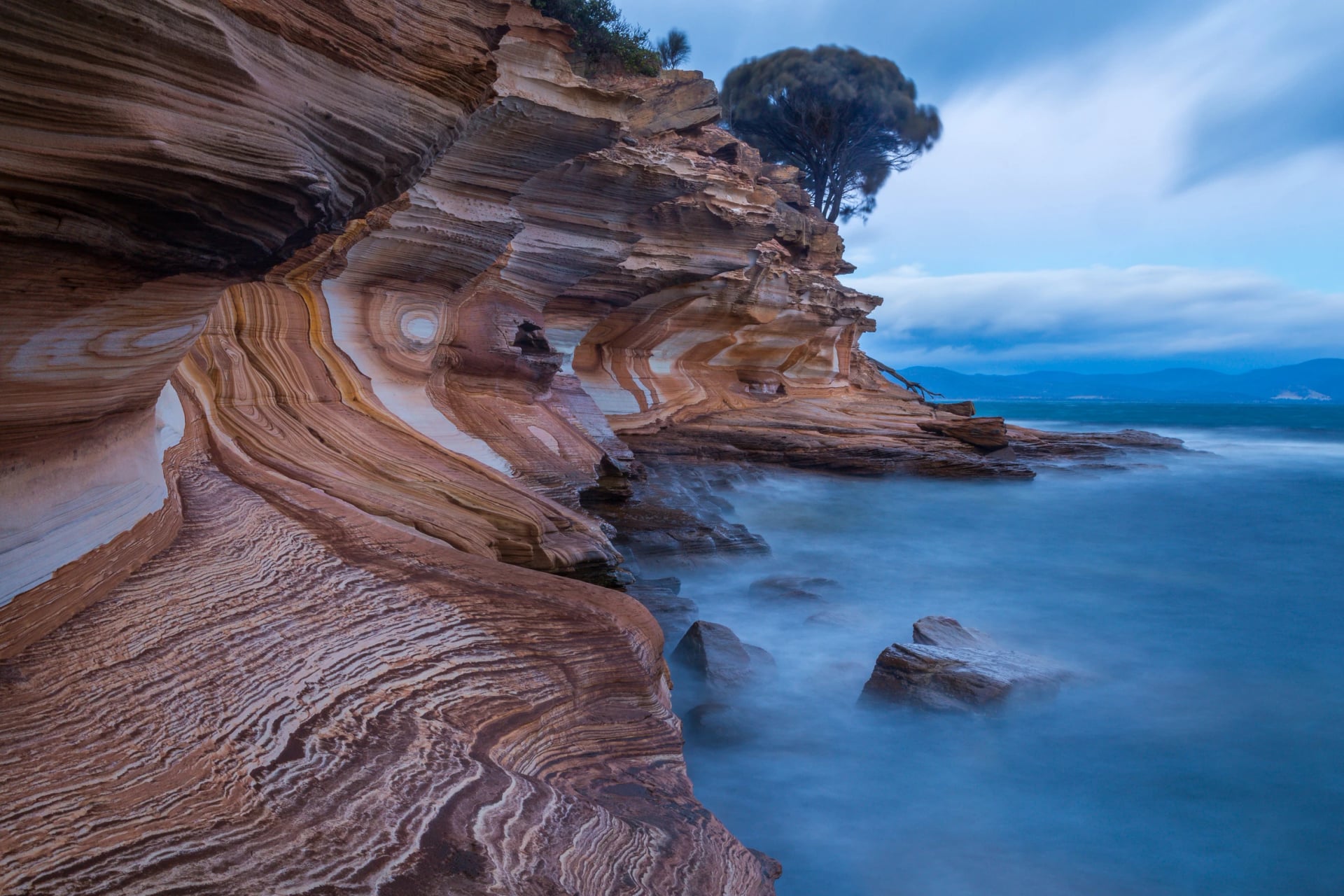
The island's big hike is the Bishop and Clerk, 11 km return from Darlington and four to five hours, ending in a rock scramble to the 620 m summit and sheer, unfenced drops on top. Leave it for another day if the wind is strong. The easier choice is the Painted Cliffs, 4.3 km return, where the rock platform below them is cut off except in the two hours either side of low tide.
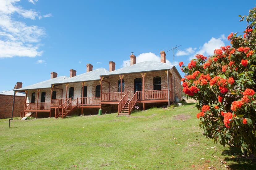
Works at Darlington run until about November 2026, on the water, sewage and power supply, so expect machinery around the old convict buildings until then.
We've mapped the climb from the jetty, with the Painted Cliffs marked for an easier day:
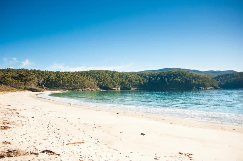
Wineglass Bay and the Hazards
Freycinet's famous view comes at four levels of effort:
Wineglass Bay Lookout: 2.6 km return, 1 to 1.5 hours, steep but with seats on the way up
Down to the beach: 6 km return, 2.5 to 3.5 hours, with about 1,000 stairs below the saddle
Wineglass Bay and Hazards Beach: an 11 km circuit of 4 to 5 hours, and the day walk we rate highest in the park
Mount Amos: 3.6 km return and about 3 hours on bare granite, which Parks Tasmania warns is slippery after rain
The Freycinet Peninsula Circuit is the multi-day option: 27 km, usually walked in two or three days, anticlockwise from the Wineglass Bay car park. You sleep in small campsites at Wineglass Bay, Hazards Beach and Cooks Beach, which take no bookings, and water is so scarce that you boil whatever you find. We don't run the circuit, but you can walk its Cooks Beach end in a day, starting from a water taxi and finishing over the saddle above Wineglass Bay.
This map from our team shows the circuit, with Mount Amos and the water-taxi beach at Cooks Beach marked:
The Bay of Fires
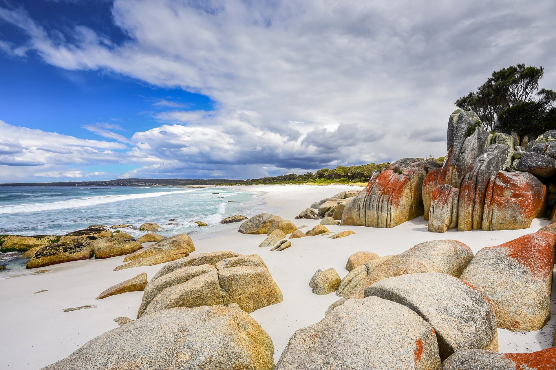
The Bay of Fires is a shoreline more than a track. From Binalong Bay it stretches north to Larapuna / Eddystone Point, and Parks Tasmania calls it "perfect for long leisurely walks". That is the way to do it: pick a beach, walk to the next headland, swim if the bay is sheltered, and turn back or carry on. The bays drop steeply and have rips, so choose where you swim. The northern end lies inside Mount William National Park, where the parks pass applies.
Two guided walks spend several days on this coast. The Tasmanian Walking Company's walk sleeps in a lodge above the sea. The wukalina Walk, owned and run by Palawa people, crosses Wukalina / Mount William to Larapuna and spends its nights in huts at Krakani Lumi and in the old lightkeepers' cottage.
Follow the shore on our map, from The Gardens south to Binalong Bay:
Lining up the boat to Maria Island, the Freycinet water taxi and coaches that don't run every day is where most east-coast plans get complicated. Our ready-to-walk tour has every connection worked out in advance, from south to north, with our team on call if a sailing is delayed.
Cradle Mountain and the Overland
For many visitors, Cradle Mountain is the picture of Tasmania: a jagged dolerite peak above a dark lake. It is also where the island's weather is hardest to predict, so give the big walks here a spare day. Cars can't reach Dove Lake in shuttle hours, so every Cradle walk begins at the visitor centre. The shuttle takes about 20 minutes and is included in the Cradle Mountain day pass, $30.70 an adult.
Dove Lake Circuit
The circuit goes right round the lake below the mountain: 6 km, 2 to 3 hours, walked clockwise. If the cloud is down, the Crater Lake circuit (5.7 km, about 2 hours) and the 20-minute Enchanted Walk are good second choices.
Have a look at the loop before you go; it starts and ends at the car park on the lake's northern shore:
Cradle Mountain Summit
From the shore of Dove Lake the top looks close, but the Cradle summit takes about eight hours return: 12.8 km, with 600 m of climbing and a long stretch over large boulders to the top at 1,545 m. Parks Tasmania grades it 5, its top grade, meant for "very experienced bushwalkers with specialised skills". Turn back in wind, rain or snow. The boulders are the worst place to meet any of them.
Study the route before you set off: it leaves the lake, climbs past Marions Lookout and only then turns towards the summit:
The Overland Track
The Overland is Tasmania's best-known multi-day walk: 65 km from Ronny Creek, below Cradle Mountain, to Narcissus at the top of Lake St Clair, usually in six days. From Narcissus you either take the lake ferry, booked separately before you start, or walk the last 17.5 km along the shore.
We don't arrange the Overland Track. Here is what getting a place involves. From 1 October to 31 May Overland walkers need a booking: $312 an adult for the 2026–27 season, with park entry and the Cradle shuttle included. Bookings open on the first Tuesday in July (7 July for this season), up to 34 independent walkers may start each day, everyone walks north to south, and there is no waitlist. Outside the season you register instead. The huts can't be booked, so every Overland walker carries a tent.
A usual six days, by Parks Tasmania's walk notes:
Ronny Creek to Waterfall Valley, 10.7 km, past Crater Lake and up to Marions Lookout
Waterfall Valley to Windermere, 7.8 km
Windermere to Pelion, 16.8 km, the longest day
Pelion to Kia Ora, 8.6 km
Kia Ora to Windy Ridge, 9.6 km
Windy Ridge to Narcissus, 9 km, then the ferry or the lakeshore track
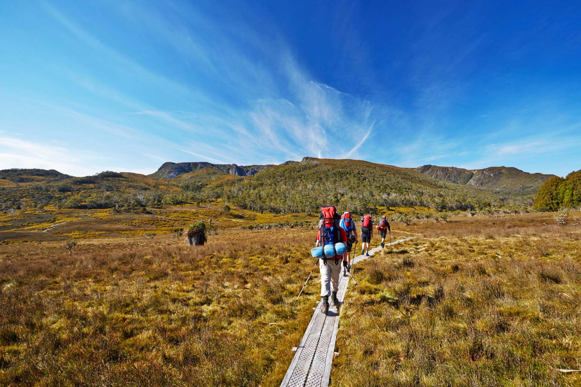
If you would rather not carry a tent, the Tasmanian Walking Company guides the track with private huts. Transport to both ends runs all year, and Parks Tasmania lists the licensed operators on its planning page.
Our map marks every public hut on the way, and the ferry across Lake St Clair at the end:
Hobart and the South West
Hobart is worth two days of walking at either end of a trip, and the south-west beyond it holds the island's hardest track.
Kunanyi / Mount Wellington
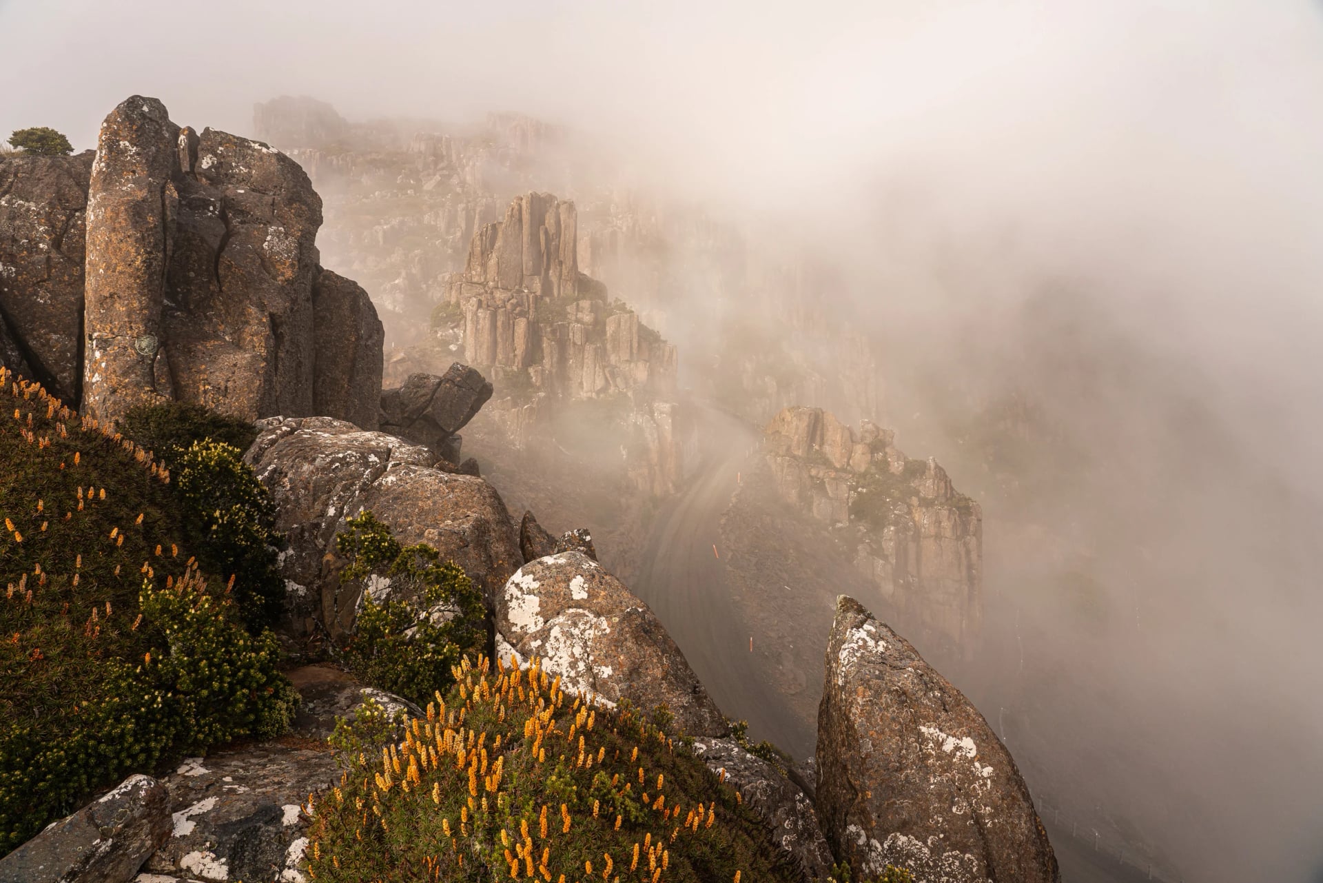
Kunanyi is the palawa kani name of Hobart's mountain, and since 2013 its official name has been Kunanyi / Mount Wellington. The mountain rises to 1,271 m behind the city, and the Wellington Park Management Trust runs it rather than Parks Tasmania, so Wellington Park needs no parks pass. The classic route is the Organ Pipes Track, under the rock columns that gave it its name: 7.4 km return from The Springs, about 3 hours.
Without a car, take the Metro bus to Fern Tree (route 448 on weekdays, 449 at weekends) and walk 50 minutes up to The Springs, or ride the Explorer Bus from the waterfront to the summit. Kunanyi's summit can be 12 degrees colder than the city, and the park closes on days of Extreme or Catastrophic fire danger.
It helps to see where The Springs and The Chalet sit on the mountain road, so we've mapped the track between them:
Mount Field
Just over an hour from Hobart, Mount Field holds the oldest reserve in Tasmania: Russell Falls was protected in 1885. The falls are 25 minutes return on a flat path. Up on the plateau, the Tarn Shelf circuit is 12 km and 5 to 6 hours, past small lakes and deciduous beech that turns gold in autumn.
Both walks are on one map: the Tarn Shelf loop up on the plateau and the short path to Russell Falls:
Fluted Cape
On Bruny Island, a 15-minute ferry ride from Kettering, Fluted Cape is the pick of the walks: 4 km and 2.5 hours, walked clockwise only and graded 4 by Parks Tasmania.
Here's the loop as it is walked, clockwise from Adventure Bay:
The South Coast Track
The South Coast Track is 85 km of wilderness between Melaleuca and Cockle Creek, six to eight days, and Parks Tasmania calls it "much more difficult than the popular Overland Track". Most walkers fly in to Melaleuca on a Par Avion light aircraft and walk out. The South Coast Track has no huts after Melaleuca, there are many creek crossings, and on the third day you climb 900 m onto the exposed Ironbound Range. It is for walkers who are, in Parks Tasmania's words, "experienced and completely self-sufficient". We don't arrange it.
To get a sense of the distances, see the whole track from Melaleuca to Cockle Creek:
Which Hike First?
Start from what you want to see, then let the season decide the rest.
Sea cliffs with a day pack: Cape Hauy, then Cape Raoul if the steps didn't put you off
Wombats on the path: Maria Island
A first multi-day walk with a roof: the Three Capes Track
Alpine country: the Dove Lake circuit, and the summit only on a clear, calm day
A beach at the end: Wineglass Bay, reached by way of Hazards Beach
A real expedition: the South Coast Track
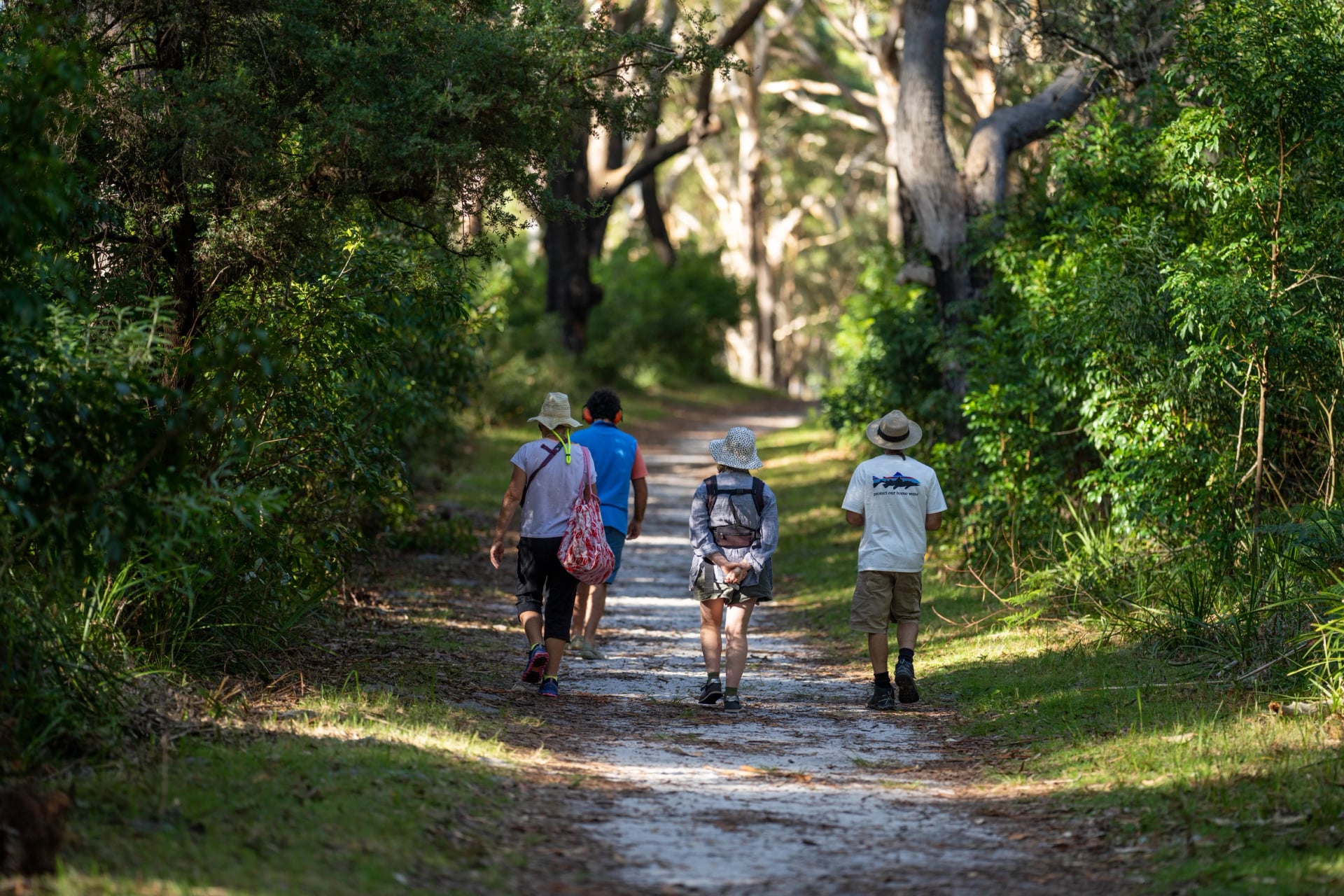
Weighing Tasmania against the mainland? Our guide to multi-day hikes in Australia sets the island's long walks beside the rest of the country's.
Places Worth the Detour
With half a day to spare between hikes, spend it at one of these. Each sits beside a walk above, and two of them are as much history as scenery.
When to Go?
Tasmania is walkable all year, but the island changes a lot from season to season, and even more between the coast and the mountains. These are the Bureau of Meteorology's long-term averages, highs and lows:
Average high / low | January | July |
Hobart | 21.8 / 12.1 °C | 11.8 / 4.6 °C |
Bicheno, east coast | 21.5 / 14.1 °C | 13.2 / 6.2 °C |
Lake St Clair, 742 m | 19.7 / 7.2 °C | 6.4 / 0.0 °C |
Summer, December to February: the warmest, driest months and the busiest on the tracks, so book the Overland and the Three Capes early. Parks Tasmania warns that bushfires can break out between October and March.
Autumn, March to May: calm, sunny days and cool evenings, by Discover Tasmania's account. The fagus turns gold in late April and early May: it is Tasmania's deciduous beech, and the best of it grows around Cradle Mountain.
Winter, June to August: short days and snow in the highlands. Lake St Clair averages 14.5 frosty nights in July, and Parks Tasmania says only very experienced walkers should take on the Overland in winter. The coast stays walkable, though the Maria Island ferry runs fewer boats and none at all on Tuesdays or Thursdays.
Spring, September to November: milder, breezy days and, says Discover Tasmania, more rainbows. Demand for the Three Capes Track is already high from September.
Daylight changes more than the temperature does. Hobart gets more than 15 hours of it at the December solstice and about nine at the June one, and that decides whether Cape Raoul or the Cradle summit fits into a day.
Whatever the month, check the forecast for the place you are walking, not for Hobart. The free BOM Weather app from the Bureau of Meteorology has 7-day forecasts, rain radar and warnings, and the Bureau now has its own forecasts for Kunanyi, Cradle Mountain and Lake St Clair.
Wildlife on the Track
Most of Tasmania's animals come out as the air cools, so the first and last hours of a walking day are when you see the most. Parks Tasmania asks walkers to keep two metres away and never feed them.
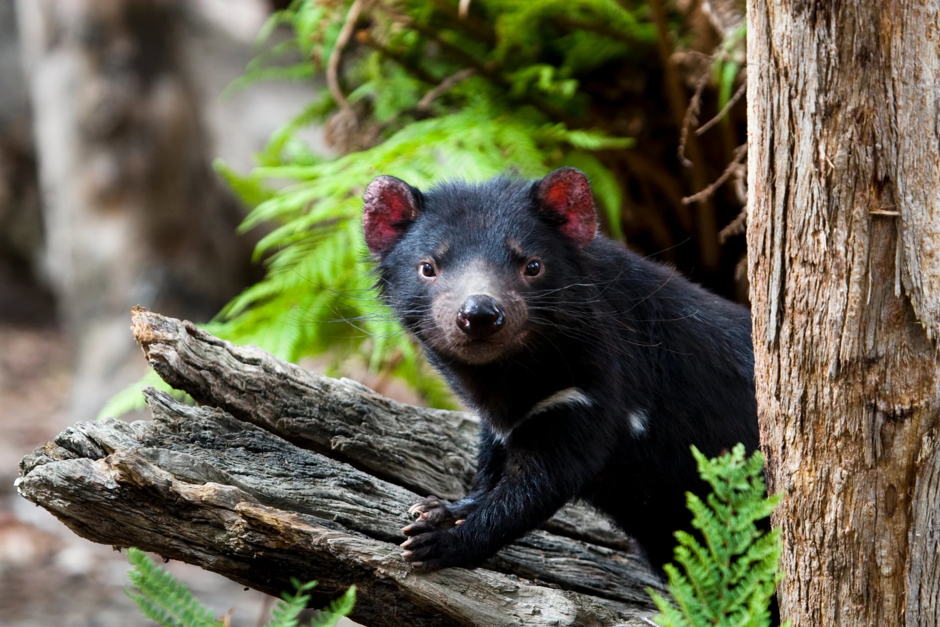
Tasmanian devil: the largest carnivorous marsupial left in the world, up to 14 kg, and nocturnal, so you are more likely to hear one than see it. A facial tumour disease, first recorded at Wukalina / Mount William in 1996, has cut devil numbers by up to 80% where it has spread longest. Parks Tasmania released 15 devils on Maria Island in 2012.
Common wombat: mostly out at night, except on Maria Island, where wombats graze in daylight. Look down as well as around: wombat droppings are cube-shaped, a puzzle scientists solved in 2021.
Bennett's wallaby and pademelon: the wallaby has a black nose and paws and a white stripe on its lip; the stockier pademelon, with its short tail, comes out into the open after dusk.
Australian fur seal: hauled out on the rocks around the capes and islands of Tasman National Park. Adult males grow to over 2 m and 200 kg.
Forty-spotted pardalote: an endangered bird found only in Tasmania, and the Reservoir Circuit on Maria Island is one of the best places to see it. Cape Barren geese, among the rarest geese in the world, are common on the island too.
Getting Around Without a Car
Tasmania's public buses are free until 30 June 2027, a state measure introduced against rising fuel costs, and they reach more of the hikes than you might expect. What they don't reach are the trailheads at the end of gravel roads.
Flying in: Hobart has direct flights from Melbourne, Sydney, Brisbane, Perth, Adelaide, Canberra and Auckland, among others. Launceston has them from Melbourne, Sydney, Brisbane and Adelaide. Compare fares on Skyscanner.
By sea: the Spirit of Tasmania sails from Geelong to Devonport, about 9 to 11 hours.
Between towns: Kinetic, formerly Redline, links Hobart, Launceston and Devonport. Tassielink runs the east coast and the Tasman Peninsula, and Calow's Coaches serves Coles Bay, St Helens and Launceston.
Port Arthur: Pennicott Wilderness Journeys runs a bus from Hobart's waterfront, but Fortescue Bay and Cape Raoul have no bus, so book a transfer or a taxi.
Maria Island: a shuttle bus from Brooke Street Pier in Hobart meets the ferry at Triabunna.
Freycinet: Freycinet Aqua Express runs a water taxi from Coles Bay to Hazards Beach and Cooks Beach.
Cradle Mountain: McDermott's coaches run from Launceston, daily in summer and four days a week in the off-season.
On our walks, every transfer to a trailhead is booked for you.
Where You Sleep
Where you sleep shapes a Tasmanian hike as much as the track does. On the long tracks you share a hut or pitch a tent; on day hikes you come back to a bed in town.
Here is how the options compare, from the simplest to the most comfortable, so you can pick the one that matches how much you want to carry:
Public huts stand along the Overland Track, with bunks, composting toilets and rainwater tanks. Bunks go to whoever arrives first, and the tent platforms beside the huts are few: one at Pelion, nine at Kia Ora.
Bring a sleeping mat, a stove and all your food. There are no showers, hot water or cooking gear.
Built for the Three Capes Track and booked with your place on it, the cabins have bunk rooms for four or eight, with mattresses, and kitchens with gas cooktops, pots and kettles.
Bring a sleeping bag, food, a plate and cutlery
The rooms have no heating or lights
Two outdoor showers, at Munro only
Parks Tasmania lets bunkhouse rooms in the old convict Penitentiary at Darlington on Maria Island: nine rooms of six bunks and one of fourteen, with a wood heater. There is no electricity, so bring a torch, bedding and every meal, and check in after 2 pm.
Rather sleep under canvas? Free, unbooked campsites line the beaches of the Freycinet circuit and the Bay of Fires, and on the Overland and the South Coast Track a tent is part of the kit anyway.
From 3 November 2026 the paid campgrounds, Fortescue Bay and Richardsons Beach among them, move to a flat fee per site, booked online.
Motels, cabins, holiday units and small hotels wait in the walking towns, Port Arthur for the capes, Coles Bay for Freycinet and St Helens for the Bay of Fires, and this is how our walks are built: a private room with your own bathroom every night, and nothing heavier than a day pack on the trail.
Camping on These Routes
You can camp on or near most of the routes in this guide, but each park has its own way of doing it:
Tasman Peninsula: the Three Capes cabins are only for booked walkers. Campers use Fortescue Bay instead, where the Banksia campground has walk-in tent sites and hot showers, and bookings are needed from October to April. For Cape Pillar with a tent, the old Cape Pillar Track has 12 platforms at Bare Knoll.
Maria Island: pitch at Darlington and pay at the Maria Island Gateway before you board, or walk three hours or more to the free sites at Frenchs Farm and Encampment Cove. Darlington's water isn't drinkable, and its showers are off until the works finish.
Freycinet circuit and Bay of Fires: the beach sites on the circuit and the eight campgrounds along the Bay of Fires cost nothing and can't be booked, and the Bay of Fires lets you stay up to four weeks.
Cradle Mountain and Lake St Clair: Parks Tasmania lists no campground in Cradle Valley, only its eight Waldheim Cabins, so tents go to the private holiday park or onto the platforms beside the Overland's huts.
South Coast Track: sheltered campsites, most with a pit toilet.
Campfires are banned in Fuel Stove Only parks, and Tasman, Freycinet, Cradle Mountain–Lake St Clair and Southwest national parks are Fuel Stove Only all year. On a Total Fire Ban day only LPG gas cookers are allowed, and Freycinet bans those too. Leave No Trace asks you to camp at least 50 m from lakes and streams.
On our walks there's no tent to carry: each night is spent under a roof, in a private room in town.
A Week Without a Car
Here is how the Tasman Peninsula and the east coast fit together by bus, ferry and water taxi. Start on a Friday between October and April and every coach below runs (Transport Tasmania timetables, October 2026).
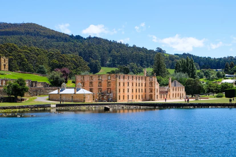
Friday: take the bus from Hobart's waterfront to Port Arthur and spend the afternoon at the Historic Site
Saturday: walk Cape Hauy, with a transfer booked ahead to Fortescue Bay
Sunday: Cape Raoul in the morning by transfer, then the 4:45 pm bus back to Hobart
Monday: the 6:45 am shuttle to Triabunna, the Bishop and Clerk, the 4:15 pm boat back and the evening coaches north to Coles Bay
Tuesday: a water taxi to Hazards Beach, then walk home past Wineglass Bay
Wednesday: the 7:10 am coach to St Helens (weekdays only) and a taxi to Binalong Bay for the Bay of Fires
Thursday: the 8:15 am coach to Launceston and a flight home that afternoon
Move one day and a coach may not run. Or skip the hassle of planning and let us handle everything for you on one of our Tasmania walking tours.
Passes, Bookings and Safety
Parks pass: every national park needs one. A walker on foot or by bus pays $24.55 for a day, and a two-month Holiday Pass costs $49.20, covering all of them (2026–27). Buy online, at a visitor centre or at the machine at the Wineglass Bay trailhead.
Booked walks: the Overland in season and the Three Capes Track need a place booked through Parks Tasmania. Frenchmans Cap and the Walls of Jerusalem need registration, and day walks need only the pass.
Closures: track works and fire closures are posted on Parks Tasmania's alerts page. Check it the evening before.
Fire: TasALERT is Tasmania's official source of emergency warnings, bushfires included. Check it on the morning of every walk.
Weather: Parks Tasmania's line is that "snow, hail, rain, wind and sun are all possible at any time of the year". Pack a waterproof jacket, a warm hat and a sunhat for every walk.
Signal and beacons: mobile coverage cannot be relied on, so write your plans in the log book at the trailhead. Service Tasmania shops in Hobart, Launceston, Burnie and Devonport hire out personal locator beacons on weekdays, as do the Cradle Mountain, Lake St Clair and Mount Field visitor centres. Dial 000 in an emergency.
Plan Your Tasmania Walk
Tell us which of these hikes caught your eye and when you can travel. Our agents book the rooms, the trailhead transfers, the ferry and the boat, and send you a detailed guidebook before you leave. Tell us when you can travel or, if you'd rather talk it through, book a free call with one of our agents.
Frequently Asked Questions



Plan with a travel expert
Free advice from a team that knows these routes inside out - real people, not a bot

HASSLE-FREE
We handle itineraries, accommodations, and anything else you prefer not to deal with, so you can enjoy a carefree hike.

BOOK WITH CONFIDENCE
We are a financially protected company, fully bonded and insured, keeping your money safe and allowing you to travel with confidence.

TRIED & TESTED ADVENTURES
We chose these walks for the scenery, then made sure each has a roof every night and needs no hire car.

HELP ON THE WALK
Plans changed, or something not as booked? Ring the support number in your guidebook. For police, fire or ambulance, call 000, even without credit.